El Niño’s Return and Its Ripple Effects on Global Weather
Warmer-than-usual water across the central and eastern tropical Pacific is again changing the winds and rainfall above it. NOAA confirmed El Niño’s return on June 11 and expects the event to strengthen through the Northern…
Warmer-than-usual water across the central and eastern tropical Pacific is again changing the winds and rainfall above it. NOAA confirmed El Niño’s return on June 11 and expects the event to strengthen through the Northern Hemisphere winter of 2026–27. [1]
The effects can extend far from the Pacific. In June, forecasts are drawing attention to South Asia’s monsoon and hurricane activity in the Atlantic and Pacific. Some regions may experience longer dry periods while others receive additional rain, with the timing and strength of El Niño helping determine how these changes develop. [2]
What Is El Niño?
Under normal conditions, trade winds blow east to west along the equatorial Pacific and push warm surface water toward Asia. Colder water rises near South America to replace it, a process called upwelling. El Niño develops when the tropical Pacific becomes warmer and the winds above it change. [3]
As the trade winds weaken during El Niño, warm water spreads east and less cold water reaches the eastern Pacific’s surface. The expanded area of warm water changes where clouds develop and rain falls. [3]
Warm, moist air rises over the warmer water, so the eastward movement also shifts more tropical rainfall away from Indonesia and northern Australia. The accompanying atmospheric changes can weaken the trade winds further, allowing the ocean to continue warming. [4]
Changes in air pressure and winds carry these effects beyond the tropical Pacific. They include changes to fast-moving winds high in the atmosphere that steer storms, allowing an ocean change to influence rain and storm activity thousands of miles away. [5]
El Niño is the warm part of a natural cycle called the El Niño–Southern Oscillation, or ENSO. La Niña is its cooler phase. When neither is present, conditions are described as neutral. [4]
How El Niño Changes Rainfall
In South Asia, the summer monsoon supplies rain during the growing season. El Niño can weaken the winds that support that rainfall, increasing the chance of a dry season. The World Meteorological Organization’s early-June assessment reports that South Asia is expected to receive below-average monsoon rain this year. [2]
The connection is not the same in every year. During the strong El Niño of 1997, India’s June–September rainfall was close to normal, and other El Niño years have brought above-average rain as well as serious shortages. [6] A national forecast also cannot establish how much rain a particular district will receive or when its dry spells will occur.
Indonesia often becomes drier as the main area of tropical rainfall moves east. Eastern Australia also tends to receive less rain, particularly in winter and spring. Since Australia’s winter starts in June, these effects can appear well before winter in the Northern Hemisphere. Other ocean and atmospheric conditions may strengthen or offset the drying. [4][5]
The season makes a difference in East Africa too. This year’s June–September outlook indicates below-normal rain across much of the northern Greater Horn of Africa. [7] The wetter ‘short rains’ often linked to El Niño come later, between October and December. Describing the whole region as likely to become wetter overlooks this change through the year. [8]
Central America and northern South America commonly become drier during El Niño, while parts of southern South America can receive more rain. [2] In the southern United States, the usual wetter pattern is mainly a winter effect. It does not tell us whether June will be wet. [3]
What It Means for Hurricane Season
El Niño usually increases wind shear in the Atlantic, meaning winds differ in speed or direction at different heights. This can tilt a developing storm and prevent its thunderstorms from remaining organised around the center, making hurricane formation and strengthening more difficult. [9]
Conditions often become more favourable for hurricanes in the eastern and central Pacific. Wind shear can fall while warmer water provides additional energy, so a less active Atlantic season can occur alongside greater activity in the Pacific. [5][9]
NOAA’s outlook entering June gives a 55% chance of a below-normal Atlantic hurricane season. The expected arrival of El Niño is a major reason for that forecast. Its influence may become more apparent later in the season as the event strengthens. [9]
The outlook concerns activity across the Atlantic as a whole. It cannot predict months ahead whether a particular town or coast will be struck, and even a season with few storms can cause severe damage if one reaches land. Forecasts for individual storms and local warnings remain necessary for coastal residents. [10]
El Niño and Global Warming
El Niño temporarily increases global average temperature on top of the longer-term warming caused by greenhouse gas emissions. The Intergovernmental Panel on Climate Change identifies human activities, mainly through those emissions, as the cause of observed warming since the preindustrial period. [8][11]
The temperature effects of El Niño take time to develop. Events often begin between March and June, reach their greatest strength between November and February, and have their largest effect on global temperature in the following year. [8] The event developing this June could therefore affect temperatures well into 2027.
The warmer conditions in which El Niño now occurs can also make some of its effects worse. Extra heat can speed up drying where rain is scarce, and a warmer ocean and atmosphere can increase the risk of heatwaves and heavy rain. [2][8] WMO’s June–August outlook points to above-normal temperatures across much of the world. [2]
Other weather patterns continue to influence conditions during an El Niño year. A heatwave, drought, or flood cannot automatically be attributed to El Niño simply because it happens during the event; its causes need separate assessment. [5]
Effects on Farms and Water Supplies
For farmers who rely on rain, a dry spell can damage crops before harvest. Rice and maize are among the crops that can come under stress when El Niño weakens monsoon rainfall. Livestock can suffer too, as pasture dries out and water becomes harder to find. [12]
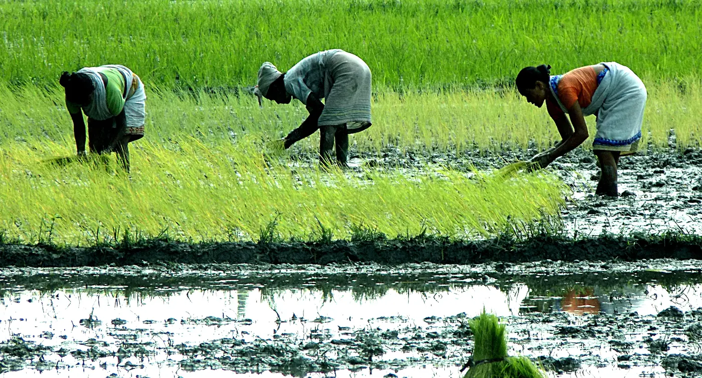 Women working with rice seedlings in Assam, India, in July 2017. Monsoon rainfall shortages can put rice crops under stress. [12]
Credit: ঈশান জ্যোতি বৰা / Wikimedia Commons, CC BY-SA 4.0.
Women working with rice seedlings in Assam, India, in July 2017. Monsoon rainfall shortages can put rice crops under stress. [12]
Credit: ঈশান জ্যোতি বৰা / Wikimedia Commons, CC BY-SA 4.0.

A poor harvest leaves less food to consume or sell. Families with limited savings may find it difficult to replace seed or purchase livestock feed, and selling animals to meet immediate costs can reduce what they have available next season. Limited money and unreliable water supplies can make recovery harder. [12]
With early forecasts, farmers and local agricultural advisers can consider changing planting dates, selecting suitable crop varieties, storing feed, or securing water reserves. [12] The appropriate response depends on the crop, the local outlook, and the resources a household can access.
Water and electricity providers can use seasonal forecasts too. They help managers plan for changes in water availability and energy needs over the coming months. [5] A regional warning becomes more useful when it is specific enough to guide decisions about water use, crop planting, or support for households facing shortages. [7]
What Happens After June
Scientists track temperatures at the Pacific’s surface and below it, together with winds and rainfall, to assess whether El Niño is strengthening and how long it may continue. NOAA’s Tropical Atmosphere Ocean network gathers ocean and weather measurements using buoys across the tropical Pacific. [13]
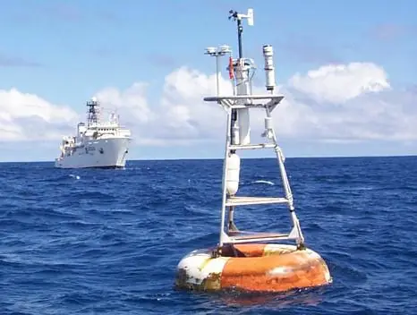 A TAO/EPIC buoy in the eastern Pacific. Buoys measure the ocean temperatures and winds that help scientists track El Niño. [13]
Credit: NOAA / Pacific Marine Environmental Laboratory, TAO/EPIC project archive.
A TAO/EPIC buoy in the eastern Pacific. Buoys measure the ocean temperatures and winds that help scientists track El Niño. [13]
Credit: NOAA / Pacific Marine Environmental Laboratory, TAO/EPIC project archive.
NOAA’s next scheduled ENSO update is July 9. [1] Regional forecasts will also be updated as conditions change. They account for El Niño alongside other influences, including temperatures in the Indian Ocean. [2]
Updates from a national meteorological service connect the wider El Niño outlook with local rain, temperature, and storm forecasts. Those forecasts help translate changing seasonal probabilities into decisions about planting, water use, or preparation for a storm. [7][10]
Sources
- ENSO Diagnostic Discussion
- WMO: Prepare for El Niño
- What are El Niño and La Niña?
- El Niño and La Niña
- ENSO FAQ
- EL Nino ISMR
- Below normal rainfall expected for norther Greater Horn of Africa
- El Niño / La Niña Phenomena
- How does El Niño Impact Atlantic Hurricane Season
- NOAA 2026 Eastern Pacific Hurricane Season Outlook
- Summary for Policymakers
- El Niño is coming. Here is where the risks to agriculture are highest
- Building TAO